
HawkEye 360: Why Listening From Space Can Beat Satellite Imaging
HawkEye 360 doesn't photograph the Earth. Its satellites listen for radio signals, from ship radars to GPS jammers, at night and through clouds. Here's where it's used today, where it's heading, and why it may matter more than another camera in orbit.
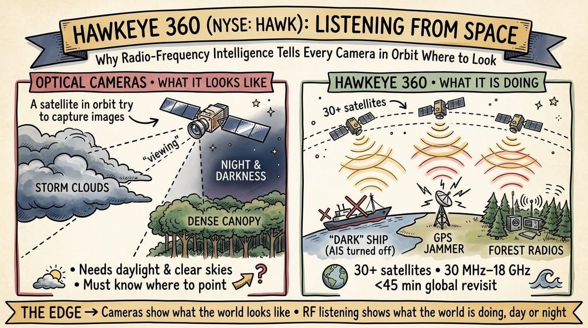
Most of what we know about satellites comes from pictures.
A ship in a harbour, a convoy on a road, a new runway in the desert.
HawkEye 360 does something different.
Its satellites listen for radio signals and work out where on Earth they came from.
The company listed on the NYSE in May under the ticker HAWK, and it reported its third quarter results this week.
I think it's one of the most interesting companies in the space economy right now.
It answers a question cameras struggle with: who is out there, and what are they doing when nobody can see them?
How HawkEye 360 Actually Works
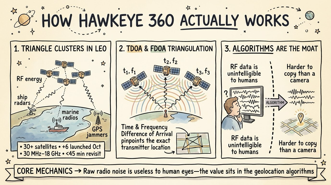
Anything that transmits leaves a trace.
Ship radars, marine radios, push-to-talk radios and GPS jammers all give off radio frequency (RF) energy.
HawkEye 360 flies small satellites in formations of three in low Earth orbit.
When several satellites pick up the same signal, tiny differences in arrival time and frequency let the company calculate where the transmitter is.
Engineers call these techniques time difference of arrival and frequency difference of arrival.
In its S-1 filing, the company described a constellation of over 30 satellites, collecting across roughly 30 MHz to 18 GHz, with a global revisit rate of under 45 minutes.
It launched six more satellites in October.
The filing makes one point I found telling: "Unlike imagery, the RF data form is unintelligible to humans."
A photo analyst can look at a picture.
Nobody can look at a raw radio signal and see a ship.
So the value sits in the algorithms that turn signals into a dot on a map, and that's much harder to copy than a camera.
The Use Cases Today
Today's customers are mostly governments.
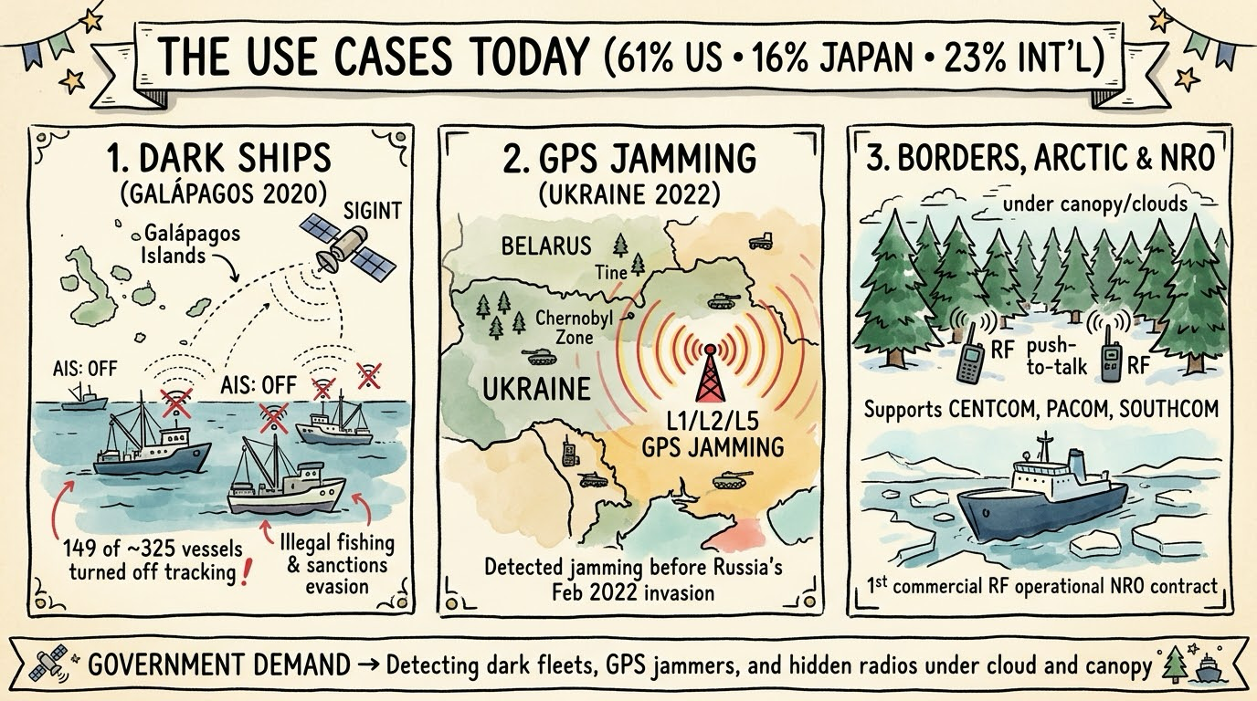
U.S. customers, mainly government agencies, made up 61% of 2025 revenue, with Japan at 16% and other international customers at 23%.
Here's what they're paying for.
Dark ships.
Vessels can switch off AIS, the transponder that broadcasts their identity and position.
Many keep using their radars and radios, and those signals can still be picked up from orbit.
In 2020, HawkEye 360 tracked the Chinese fishing fleet off the Galápagos and said vessels switched off AIS "hundreds of times."
Ecuador's government said 149 of about 325 vessels had turned off their tracking systems.
Illegal fishing, sanctions evasion and smuggling all depend on ships going dark, so this is a big market.
GPS jamming.
HawkEye 360 detected GPS interference near the Ukraine-Belarus border, inside the Chernobyl Exclusion Zone, shortly before Russia invaded Ukraine in February 2022.
Jamming and spoofing detection across the L1, L2 and L5 GPS bands is now one of its core products.
Borders, the Arctic and military operations.
The company has shown it can detect push-to-talk radios under Canadian forest canopy, where imagery can miss activity entirely.
It has also mapped Arctic shipping routes that didn't show up on AIS.
In its Q3 materials, management said it directly supports CENTCOM, PACOM and SOUTHCOM.
It also became the first commercial RF provider to move from testing with the National Reconnaissance Office to an operational augmentation contract.
I've written about how the Department of War is partnering with In-Q-Tel to move commercial technology into the field faster.
HawkEye 360 is exactly the kind of commercial supplier that shift rewards.
Why Listening Can Beat Looking
Optical satellites need daylight and clear skies.
Clouds, foliage and terrain all create blind spots.
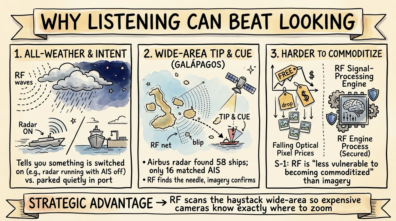
Radio signals pass through clouds and don't depend on sunlight.
The S-1 puts it as "persistent, wide-area coverage that remains effective in conditions where optical sensors often fail."
Radar imaging satellites can also see through clouds and darkness, so the bigger advantage is something else.
A picture tells you what something looks like.
A signal tells you that something is switched on, and often what kind of equipment it is.
A fishing boat with its radar running and its AIS off is behaving very differently from one sitting quietly in port.
RF is also a wide-area search tool.
Imaging satellites usually need to know where to point.
An RF constellation can scan huge areas and flag the activity worth photographing.
The Galápagos case shows how the two work together.
An Airbus radar image found 58 vessel locations, and only 16 of them matched AIS data within an hour either way.
RF finds the needle, and imagery confirms what it is.
There's a business advantage too.
The company argues in its S-1 that RF is "less vulnerable to becoming commoditized" than optical and radar imagery constellations.
I think that's broadly right, because pixels keep getting cheaper while signal processing is still specialised work.
Where Imaging Still Wins
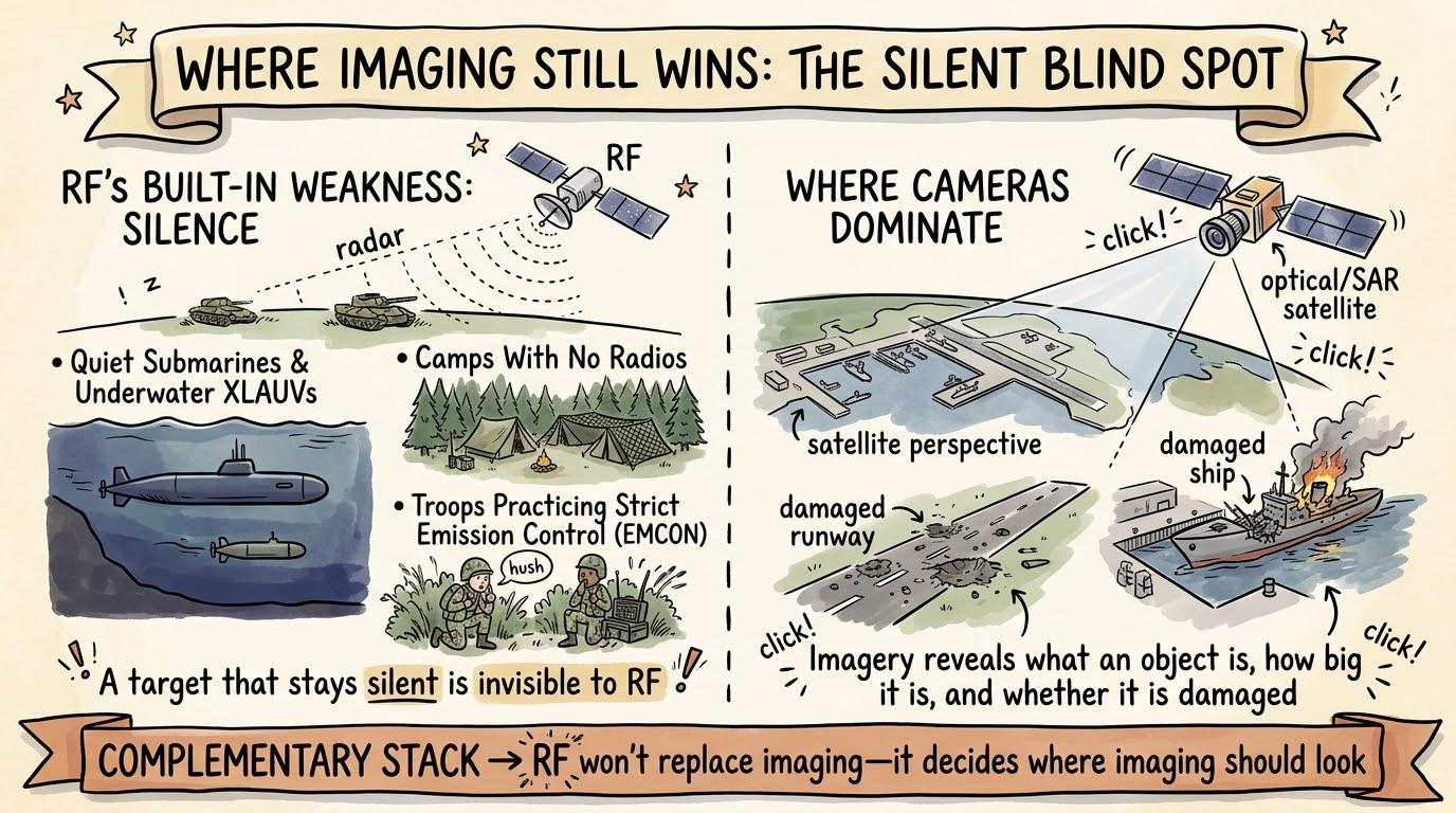
RF has one weakness built in.
A target that stays silent is invisible to it.
A quiet submarine, a camp with no radios or a military unit practising strict emission control won't show up.
I've written about extra-large autonomous underwater vehicles, and those are exactly the kind of platform an RF satellite will struggle to find.
Imagery is also better at telling you what an object is, how big it is and whether it's damaged.
So I don't see RF replacing imaging.
I see it deciding where imaging should look.
The Use Cases Of The Future
The roadmap is where it gets interesting.
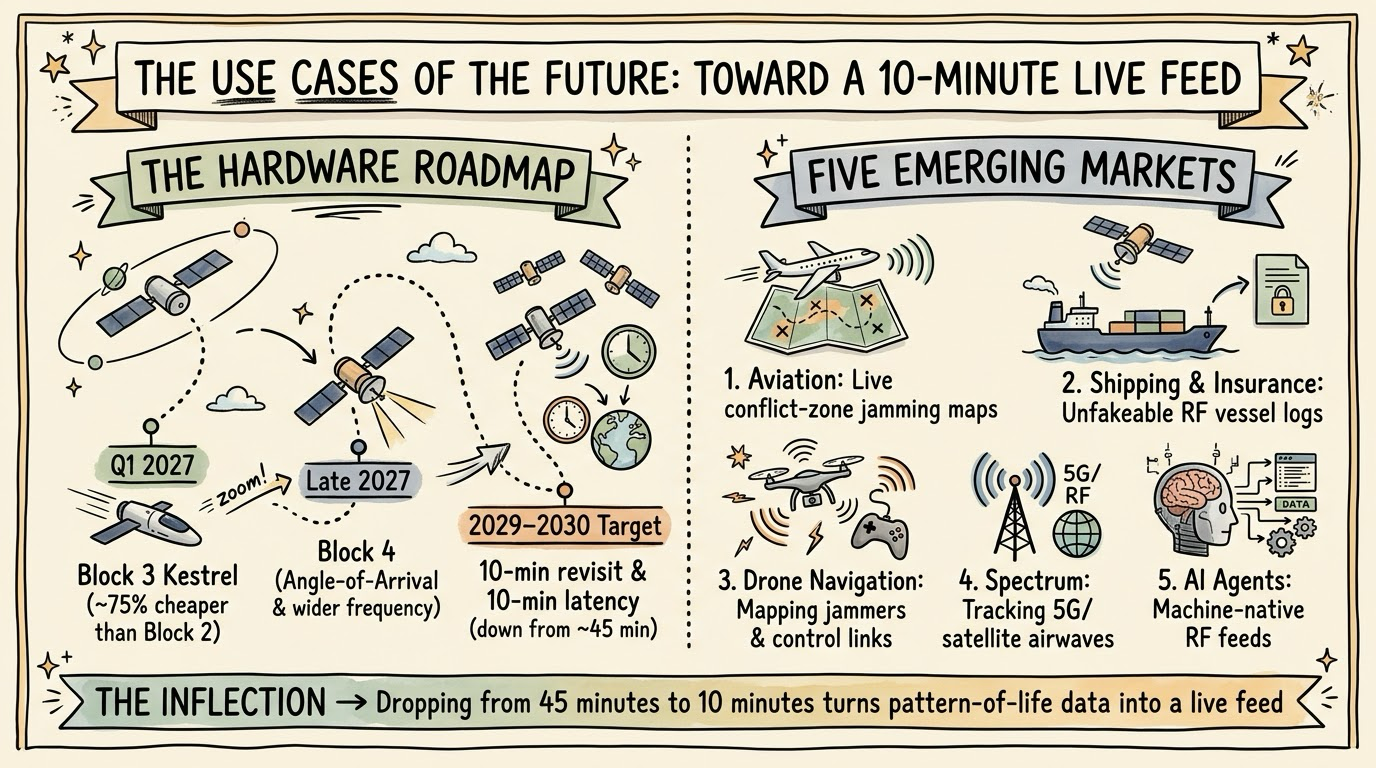
In its Q3 slides, HawkEye 360 targets 10-minute revisit rates and 10-minute data latency by 2029 to 2030.
Its Block 3 Kestrel satellites are on track to launch in Q1 2027 and are reportedly about 75% cheaper than Block 2.
Block 4 is expected to be demonstrated by late 2027, adding angle-of-arrival technology and wider frequency coverage.
A 10-minute refresh changes what the data is good for.
Roughly 45 minutes is useful for patterns of life.
Ten minutes starts to look like a live feed.
These are my own predictions for where that leads:
- Aviation: Airlines flying near conflict zones could use live jamming maps as part of flight planning.
- Shipping and insurance: Insurers and sanctions teams need to know where a ship really went, and an independent RF record is harder to fake than a transponder.
- Drone warfare: Drones and counter-drone systems depend on radio links and GPS, so mapping jammers and control links quickly will matter more.
- Spectrum management: As satellites and 5G crowd the airwaves, regulators and telecoms may want an independent view of who is transmitting where.
- AI agents: RF data is unreadable to humans anyway, which makes it a natural fit for the autonomous agents I expect to drive the space economy.
The Business So Far
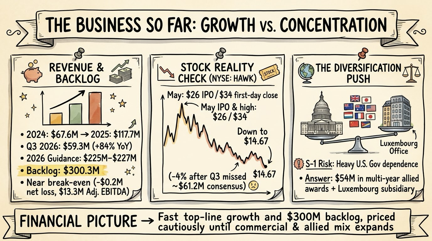
Revenue grew from $67.6 million in 2024 to $117.7 million in 2025.
In Q3 2026, revenue reached $59.3 million, up 84% year on year.
International revenue was $23.3 million, up 76%.
Backlog stood at $300.3 million, and the company raised its full-year revenue guidance to $225 million to $227 million.
It's close to break-even, with a $0.2 million net loss in the quarter and $13.3 million in adjusted EBITDA.
The market wanted more.
Revenue came in below the roughly $61.2 million analysts expected, and the stock fell about 4% to $14.67 in regular trading.
That's well below the $26 IPO price and the $34 first-day close in May.
The S-1 is also clear about concentration risk: "We depend on the U.S. Government for a substantial portion of our business."
The international push, including $54 million in multi-year awards from 11 allied partners and a new Luxembourg subsidiary, is the company's answer to that.
Conclusion: The Next Layer Of Earth Observation
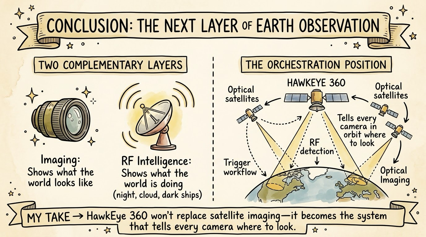
Satellite imaging showed us what the world looks like.
RF intelligence shows us what the world is doing, at night, under cloud and when ships try to hide.
HawkEye 360 has the constellation, the government contracts and a roadmap toward near real-time data.
The open questions are execution and how far it can grow beyond defence budgets.
My Take: HawkEye 360 won't replace satellite imaging, but it could become the system that tells every camera in orbit where to look, and that's a more valuable position than owning another camera.
This post is for information only and isn't investment advice.
Sources
Pages I opened for the facts in this post:
- SEC: HawkEye 360 S-1 registration statement
- SEC: HawkEye 360 Q3 2026 earnings release
- Investing.com: HawkEye 360 Q3 2026 slides
- IPO Scoop: HawkEye 360 prices IPO at $26
- Renaissance Capital: HawkEye 360 prices IPO
- GeoConnexion: Seeing with radio
- Seapower: HawkEye 360 tracked Chinese activity near the Galápagos
- Aviation Week: HawkEye satellites detect GPS jamming before Ukraine invasion